
Itinéraires Radovljica
Cliquez sur un itinéraire pour afficher ses statistiques, sa carte et son profil.
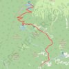
J4B_Roblek
Standard approach from to to the legendary Roblek Mountain leads from Draga valley through the dense forests and alpine pastures of Mt. Begunjščica.
Distance : 11,2 Km • Dénivelé positif : 959 m • Altitude maximum : 1.633 m
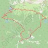
J4A_Roblek
This curcular route in the Karawanke mountain range will reward a hiker with pristine nature and beautiful views towards the Julian Alps.
Distance : 11,5 Km • Dénivelé positif : 1.074 m • Altitude maximum : 1.637 m