
Itinéraires Pavezin
Cliquez sur un itinéraire pour afficher ses statistiques, sa carte et son profil.
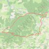
Le Crêt de Quatregrain
France > Auvergne-Rhône-Alpes > Loire > Pavezin > Col de Pavezin
Randonnée en boucle depuis Pavezin. Massif Central. #Randonnée #Boucle #MassifCentral #Montagne #Nature
Distance : 11,9 Km • Dénivelé positif : 492 m • Altitude maximum : 873 m
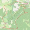
Grange Rouet
France > Auvergne-Rhône-Alpes > Loire > Pavezin > Grange Rouet
Randonnée en boucle depuis Pavezin. Massif Central. #Randonnée #Boucle #MassifCentral #Montagne #Nature
Distance : 8,3 Km • Dénivelé positif : 398 m • Altitude maximum : 872 m
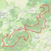
Pavezin
France > Auvergne-Rhône-Alpes > Loire > Pavezin
Randonnée en boucle depuis Pavezin. Massif Central. #Randonnée #Boucle #MassifCentral #Montagne #Nature
Distance : 21,7 Km • Dénivelé positif : 866 m • Altitude maximum : 883 m
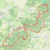
Pavezin
France > Auvergne-Rhône-Alpes > Loire > Pavezin
Randonnée en boucle depuis Pavezin. Massif Central. #Randonnée #Boucle #MassifCentral #Montagne #Nature
Distance : 20,6 Km • Dénivelé positif : 819 m • Altitude maximum : 883 m